Showing posts with label place names. Show all posts

A Little Bit of Ancient Carrick History, Part Three: Silver Spurs


Looking towards the new manse.


Near to the natural mound of Kirkmichael House (called Kirkmichael Tower on Pont’s map) is a house called Fairy Knowe. Incidentally, if you want to have a look at a series of old and interesting maps of Scotland, including Carrick, you can see and search them all online on the National Library of Scotland's site here.

Most fairy knowes have nothing to do with the fairies, and this one hasn’t either. Instead it comes from the Scots Gaelic faire, meaning watch or guard hill. But a guard hill for what? Fairy knowes are strategically placed near castles or forts of some sort. Fairy Knowe looks towards Maybole, commanding fine views over the surrounding countryside. To the north is Drumore, the big ridge. The name suggests an outlying rampart of something. West of Kirkmichael House is Auchenairney or the Field of Sloes – and still has sloes to this day. What seems to be true is that for many hundreds and perhaps thousands of years people have lived not just in, but around Kirkmichael House, which would have been as important to the village as the kirk. Even within the village is a house named Clawbeg that appears on old maps – with the name meaning ‘small mound’ or barrow. 

There are other place names of interest within the parish. Drumdarragh is a farm mentioned in old records. It seems to have disappeared, but in 1711 we find two farms referred to as Upper and Nether Dundarrach, which translates as small fort of the oaks, and there is an Aikenhead farm in this area today, which of course means much the same thing, but in English. 

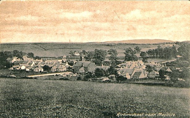
Natural mound of 
Kirkmichael House 
Maybe Dundarrach hasn’t disappeared at all.

Descriptively Port Cheek, within the village, is Gaelic, meaning the harbour where the river flows out of the hollow. As it does. The burn is the Dyrock, which was also named for the oaks that grew and still to some extent do grow along the banks. Arnsow is the height of the wise man or sage, Dalduff, the dark field, Ballycoach, the town of the wood, Barskelly, the top of the bare rock, Drumfad, the hill of peat, and so on. 

These were people who were describing and naming a landscape in which they lived and worked and were occasionally referring to people they thought of as others – such as Barbrethan, or Barbredda on the old Pont map, ‘the height where the Brits live’ - even when those others had been here for a long time. The names are, if we pay attention, still describing the place to us, but back then, they were even more important in characterising the landscape.

An English friend had been told that Guiltreehill, outside the village, had been a gallows hill. Well it's possible, but not likely. Executions would have taken place elsewhere, in centres like Maybole and Girvan and Ayr, It seems much more likely that the tree element is yet another British tref, or house name. Gil-tref may mean the house of the manservant, (as in the word ghillie.)  Maybe we see a favoured servant being given some land to build a house for himself, just as so many years later, our own house was built by a well regarded servant. 

Lead was mined up there, but the ore also yielded silver. The 1838 Statistical Account for Kirkmichael contains this tantalising reference: 'In the wacke at Guiltree-hill and Montgomerieston, veins of galena are found, of sufficient importance to have been at one time worked; and they are said to have yielded a high per centage of silver.'

That 1838 account, which can be accessed here, via the excellent Maybole site, also contains a wealth of fascinating information about the area, not least that of some 1000 people in Crosshill, 800 are Irish. The minister doesn't seem to approve of them very much. He also notes that there are ten alehouses in Kirkmichael and finds it an 'unwarrantably large number'.

When I first moved to the village, many years ago, older people would tell me that items made of Kirkmichael silver could still be found here - but I've never seen any. I'd love to know if any remain, lurking at the back of somebody's drawer, or in a box in the attic! 

The mine was certainly a very old one. Perhaps the ‘silver spurs’ that had to be paid to John Kennedy by Murdoch son of Somerled, on St Michael’s day, were made from local silver. And as I said in an earlier post, the Britonnic tribes were miners as well as horsemen and women. Intriguingly, Orchard Farm, and Cloncaird House also seem to be connected with metal working: Orchard with gold, not apples, while Cloncaird is the ‘field of the metal workers’. 

 Perhaps the whole area, back then, was noted for its metal working and perhaps the Britonnic people had those particular skills. Maybe this was an area of much more wealth and interest than we can possibly imagine.

Go to Part Four of this overview of life in the village, for a fascinating account of what life was like in an eighteenth century manse. 

A Little Bit of Ancient Carrick History, Part One: Who Lives in Carrick?


.


There's an excellent community venture going on in this small corner of Carrick to collect and collate a wealth of local history, and although I've got a brand new writing project to work on, and all kinds of things I should be doing instead, it sent me back down a rabbit hole - an enticing rabbit warren really - of a piece of research I started a long time ago. 

When I dug it out and went over it with the new project in mind, I realised that I had got lots of things wrong, and also that there was plenty more to be said - so I've spent a large part of this week digging down into it again. It's complicated - so there will be three parts. But if you too enjoy digging down into the past, you might find it useful or entertaining. 

Years ago, I did a Postgraduate Masters in Folk Life Studies at Leeds University. There was an outside chance that I was going to do place name research. Well I didn't, and I'm quite glad about that. I was always more inclined towards fiction rather than the academic world. And I do love a bit of wild speculation! But I still find place names - and personal names too - fascinating, because they're a bit like fossils: tantalising remnants of something ancient, buried in the landscape. 

Anyway - here comes a bit of background.

When the Romans first came to Britain, (in 55BC as we used to learn at school), they noted that the Iron Age tribes who lived in this part of the world – Carrick and Galloway - were the Novantae. That, however, was the Roman name for them, and we don’t know what they called themselves. We think that they probably spoke the Britonnic language that would have sounded a bit like Welsh, but we know very little else about them. 

Put simply - but it isn’t really simple, so if you’re an expert on this, bear with me while I oversimplify! - there are three kinds of Celtic language. There is Q Celtic, which probably came to these islands with waves of migration, roughly 1000 BC,  and from which Irish and Scots Gaelic are both descended. There is P Celtic or Britonnic, which was spoken throughout the island of Britain in the late Iron Age and beyond, from about 400 BC, including southern and central Scotland, and from which modern Welsh is descended Thirdly, the people we know as Picts lived north of the Forth Clyde Line and they spoke another Celtic language, although scholarly debate still rages as to the nature of this tongue. 

We also know that there were brochs – round towers that tend to be associated with Picts like the one in the picture  – as far south as Galloway, and it’s now recognised that there were southern Picts too. On balance Pictish was probably closer to P Celtic. Place names provide a clue to the nature of their language, as do some surviving inscriptions that use the Latin alphabet. 

Complicating matters still further is the notion that earlier Bronze age tribes may have been similar culturally and linguistically to the Q Celts who were displaced by incoming Britonnic tribes. Some even  speculate that the Novantae could be the remnants of Bronze age people. 

The Roman geographer, Ptolemy, who wrote about the tribes of Britain, but didn't have much to say about the Novantae, also recorded 38 native place names from Scotland in the second century AD, but when place name experts look at them today, less than half are recognisably Britonnic or Gaelic. The rest are mysterious and interesting. River names, for example, are sometimes much older than other words, and perhaps date from even older languages, because the Celts were incomers too. 

Even the smallest knowledge of ancient and local history tells you that we are all, every last one of us, descended from economic migrants. Even if your blood turns out to be pure Pict or Celt, that's what you were. 

If we look at this part of South Ayrshire, we can see that over the first millennium AD, especially after the Romans departed, Celtic peoples travelled between here and Ireland. No doubt they would have intermarried and learned each other’s languages. In time, the ‘English’ came north and complicated things even more. Northumbrian Angles settled in Galloway, in the seventh and eighth centuries AD, and Maybole, the capital of Carrick, was one of their northern centres of population. 

These Anglo Saxon people seem to have managed to achieve some kind of power balance with their Celtic neighbours. The Britons - and place name evidence suggests that a lot of them were P Celtic speaking Britons in this area by that time - were, by tradition, farmers, cattle and horse breeders – sometimes quite wealthy people - who lived up in the hills. They were also miners, and occupied areas where silver could be extracted and gold panned in the streams. Both Angles and Britons hunted and fished, but they weren't short of wildlife and game. The separation of one settlement from another by wide tracts of forest probably helped to maintain the peace between these rather different peoples: the Celtic people on the hills and the Angles, speaking a variety of Old English in the valleys. 

I have this wild theory that if you tested a cross section of hill top Ayrshire and Galloway farmers, those who have been farming in this area for many generations, you would still find Britonnic DNA predominating.

Time marched on. The power of Northumbria started to diminish, the Celtic kingdom of Strathclyde expanded and the balance tipped in favour of the Britonnic tribes again, although all were coping with inroads made by young Norse settlers, aka Vikings. The Strathclyde tribes were possibly rather better at this than the Northumbrians. Alliances were formed, broken, formed again. We know that in the early 10th century AD, Galloway and Carrick were still divided between largely Britonnic and Anglo Saxon enclaves but there was also place name evidence of those earlier Q Celtic speakers who had lived here, may still have been living here, and would live here again. 

Over the next hundred years or more, we see a powerful resurgence of Gaelic place names in this area, as people moved here from Ireland. Nothing is clear cut, and there may have been plenty of unrecorded interactions between the Britonnic and Gaelic speaking peoples. They may have been here all along, keeping a low profile. Nevertheless early in the eleventh century, the balance of power in this part of the world had changed. The kingdom of the Scots was established and they brought with them a language that again became dominant.

A host of Gaelic place names had come into existence - or were resurrected. Who knows?  There were hills, streams, farms and fields but even the personal names of the upper classes had become Gaelicised. It seems to have been the language rather than the population that changed. It was as though Gaelic had become fashionable. 

At the same time, people in Carrick still preserved many traces of their Britonnic descent and in this area, some Britonnic names have persisted right to the present day. Around Maybole, for example, there are many place names containing the Brittonic ‘tre’ or ‘tref’, meaning homestead. We find Troquhain, Threave, Barbrethan, Tranew, Tralorg, Traboyack, Tralodden, Trochrague, Trees and probably Guiltreehill as well, as we shall see. Pen and Pin place names may have a similar origin.

Part of the problem for those coming after is that history tends to be written in terms of the ‘high heidyins’ so we have endless (and frankly quite boring) lists of complicated relationships of the men at the top, charters etc but we know very little about everyday life. What we do know is that more and more settlements are being uncovered, places that were settled over a period of  many thousands of years, that this was quite a prosperous and cultured area a long time before the Iron Age and beyond, and that where we can’t find settlements going back thousands of years, it may well be because old farmhouses are sitting right on top of them. 

The Celts, Gaels and Britons alike, favoured hilltop forts so that they could see who was coming. So do many of the hill farmers of Carrick today. 

If you want to read more, follow the link to Part Two